MORE TO COME…
MAPS OF GERMANY
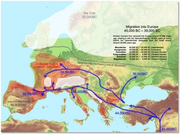
Early History of Germanic Tribes – Migration into Europe 45,000 BCE-39,000 BCE.[1]
[1] Thayer Watkins, “The Early History of Germanic Tribes,” article. Home Page of Thayer Watkins; San José State University. (http://www.sjsu.edu/faculty/watkins/ancientgermans.htm : accessed 21 Oct 2017.)

Germanic Kingdoms in Europe c. 500 CE[1]
[1] Germanic Kingdoms in Europe c. 500 AD, digital image. Wikipedia Commons (https://en.wikipedia.org/wiki/Germans#/media/File:West_Germanic_Kingdoms_460.jpg : accessed 14 Oct 2017.)
[1] “Map of the Kingdom of Germany within the Holy Roman Empire and within Europe circa 1004, after the incorporation of the Duchy of Bohemia,” digital image. Wikipedia Commons. (https://commons.wikimedia.org/wiki/File:Kingdom_of_Germany_1004.svg : accessed 22 Oct 2017.)

Holy Roman Empire in 1648 (shows the small political entities of Germany in the centre.)[1]
[1] “Holy Roman Empire,” article. Wikipedia (https://en.wikipedia.org : accessed 25 Oct 2018.)

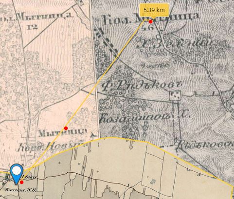
Map from 1692. File:Sanson-Jaillot, 1692 – Partie Occidentale du Palatinat (…).jpeg
In this map there is a village called “Wamerode” (blue arrow), which is very probably an old name for Womrath, and there are the nearby villages of Gemünden and Dickenschied (red arrows).[1]
[1] https://commons.wikimedia.org/wiki/File:Sanson-Jaillot,_1692_-_Partie_Occidentale_du_Palatinat_(…).jpeg ,
MAPS OF GALICIA, AUSTRIA
MAPS OF VOLHYNIA, RUSSIA

.jpeg)